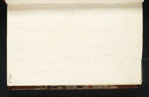
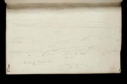
Joseph Mallord William Turner A Panorama of the Kent Estuary, with Milnthorpe, Whitbarrow Scar and Meathop Marsh 1816
Image 1 of 2
Joseph Mallord William Turner,
A Panorama of the Kent Estuary, with Milnthorpe, Whitbarrow Scar and Meathop Marsh
1816
Joseph Mallord William Turner 1775–1851
Folio 2 Recto:
A Panorama of the Kent Estuary, with Milnthorpe, Whitbarrow Scar and Meathop Marsh 1816
D11044
Turner Bequest CXLV 2
Turner Bequest CXLV 2
Pencil on white wove paper, 96 x 154 mm
Inscribed by Turner in pencil ‘Whitbarrow Scar’ top centre, and ‘Mill’ or ‘Miln’, ‘sand’, ‘L Wood’ and ‘Medcup Marsh’ across lower half
Inscribed by ?John Ruskin in brown ink ‘2’ bottom right and ‘275’ bottom left, both descending vertically
Stamped in black with Turner Bequest number ‘CXLV 2’ bottom left, descending vertically
Accepted by the nation as part of the Turner Bequest 1856
References
1909
A.J. Finberg, A Complete Inventory of the Drawings of the Turner Bequest, London 1909, vol.I, p.415, CXLV 2, as ‘Whitburne Scar,” “Medcup Marsh,” &c.’.
1984
David Hill, In Turner’s Footsteps: Through the Hills and Dales of Northern England, London 1984, pp.30, as part of ‘A panorama of the Kent Estuary in six parts, with “Mith” i.e. Milnthorpe, “Whitbarrow Scar”, “Medcup Marsh” i.e. Meathop Marsh’, 83.
This page carries four panoramic sketches, which together constitute one continuous panorama of Morecambe Bay looking out over the estuary of the river Kent near Milnthorpe. The present author has suggested that the sketches on this page might be continuous with those on folio 1 verso opposite (D11043),1 but this is not certain.
On this page the top register records the view towards Whitbarrow Scar from the east. The second register records the Coniston Old Man range across Milnthorpe Sands, if that is the meaning of the inscription ‘Mill’ or ‘Miln’. This appears to continue the first register to the right if the viewpoint is from near the mouth of the river Kent near Levens Hall from where the Coniston hills appear to the right of Whitbarrow Scar. The third register records the view south across the ‘sand’ towards the sea between Arnside Knott and the Cartmel peninsular. This appears to continue the top register to the left.
The bottom register records the view north across ‘Medcup Marsh’ along the slopes of Brigsteer Woods (inscribed ‘L [?for Levens] Wood’) to a distant Lakeland summit, probably Fairfield. This appears to continue the second register to the right. Similar material to the lower register is recorded inside the adjacent cover (D41443), and similar material to the whole panorama occurs in the background of a detailed sketch of the Kent estuary from above Dallam Tower in the Yorkshire 5 sketchbook (Tate D11595, D11529; Turner Bequest CXLVIII 42, 6).
The author has dated Turner’s sketches in the Milnthorpe area to Monday 5 August 1816.2 This sketch, made with the page turned horizontally, is upside-down in relation to the main sequence (see the sketchbook’s Introduction).
David Hill
April 2009
How to cite
David Hill, ‘A Panorama of the Kent Estuary, with Milnthorpe, Whitbarrow Scar and Meathop Marsh 1816 by Joseph Mallord William Turner’, catalogue entry, April 2009, in David Blayney Brown (ed.), J.M.W. Turner: Sketchbooks, Drawings and Watercolours, Tate Research Publication, March 2023, https://www


