Joseph Mallord William Turner The Ravine at Pont Saint-Louis, Marking the Border between France and Liguria 1828
Image 1 of 2
Joseph Mallord William Turner,
The Ravine at Pont Saint-Louis, Marking the Border between France and Liguria
1828
Folio 26 Verso:
The Ravine at Pont Saint-Louis, Marking the Border between France and Liguria 1828
D21183
Turner Bequest CCXXXI 26a
Turner Bequest CCXXXI 26a
Pencil on white wove paper, 174 x 113 mm
Accepted by the nation as part of the Turner Bequest 1856
References
1909
A.J. Finberg, A Complete Inventory of the Drawings of the Turner Bequest, London 1909, vol.II, p.709, CCXXXI 26a, as ‘Rocks’.
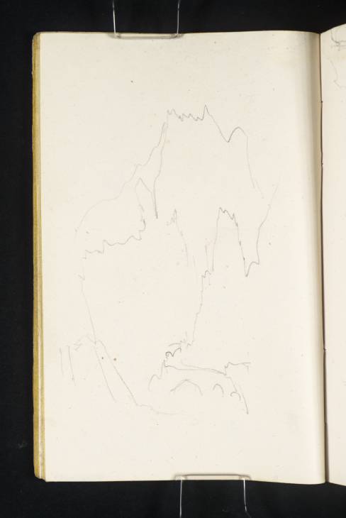
The geographer and Turner researcher Roland Courtot has identified the subject of this sketch as the ravine to the east of Menton, which marks the border between France and Liguria (the present-day Franco-Italian border).1 Turner’s viewpoint is near the edge of the seafront at the bottom of the ravine, looking north into the deep rocky recess. He has used the vertical format of the page to capture the towering columns and walls of rock.
Apparent in the foreground to the right are a series of arches underneath the road, while just visible beyond is the Pont Saint-Louis, the bridge built by Napoleon during the early nineteenth century in order to span the gorge. This very scene formed the vignette title plate for the second volume of William Brockedon’s publication, Illustrations of the Passes of the Alps (1829), and the author described the location in depth:
About a mile before arriving at Menton, the traveller passes one of the most notable works upon the route of the Cornice, – the Pont St. Louis, which is a single arch of great span, thrown across the Baussi Rossi, a ravine of fearful depth. To have a just idea of the magnificence of this undertaking, it is necessary to enter a vineyard on the lower side of the bridge. The wild aspect of the gorge is thence very striking: numerous caverns, and one of great magnitude, open into this deep and dark recess, above which the pinnacled and sterile rocks rise to an appalling height. Half-way down the ravine, an old aqueduct serves to convey a small stream which issues from the fissures to some terraces which have been planted with vines ... The Pont St. Louis was finished while Napoleon was in power; and upon its completion, the préfet and other officers of the department of the Maritime Alps gave a dinner in the great cavern to a large party. Their vivas to Napoleon are still echoed amid these rocks by every traveller.2
The same site can be seen in a drawing on folio 27 verso (D21185; left-hand sketch), while views of the surrounding coastline looking back from the border into France can be found there and on folio 27 recto opposite (D21184–D21185).
Nicola Moorby
March 2017
Revised by Hannah Kaspar
November 2024
Roland Courtot, ‘Les Carnets de William Turner: Recherches d’identification et de localisation des dessins’, unpublished research notes, Université de Provence à Aix, April 2008, p.5, as ‘Menton’ (shared with former Tate cataloguer Nicola Moorby in email correspondence at that date).
How to cite
Nicola Moorby, ‘The Ravine at Pont Saint-Louis, Marking the Border between France and Liguria 1828’, catalogue entry, March 2017, revised by Hannah Kaspar, November 2024, in David Blayney Brown (ed.), J.M.W. Turner: Sketchbooks, Drawings and Watercolours, Tate Research Publication, February 2025, https://www


