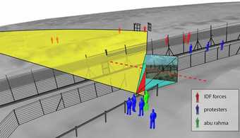
This seminar deals with contemporary modes of human and machine seeing, noticing, identifying, resolving and interpreting information that exists within images, whether historical aerial photographs, contemporary satellite images, or user-generated videos. What practices are necessary to go beyond the thresholds of resolution, the limits of the frame, the disruption of interference and blur?
The workshop will deal with techniques of open-source investigations, the sourcing of images and videos and the search for clues in them. We will discuss techniques for interpreting satellite and aerial images; the essential practice ‘geolocation’, the use of ‘before and after’ images; with the necessity for ‘ground-truthing’ remote sensing information and with capturing improvised aerial images (from kites or drones);

