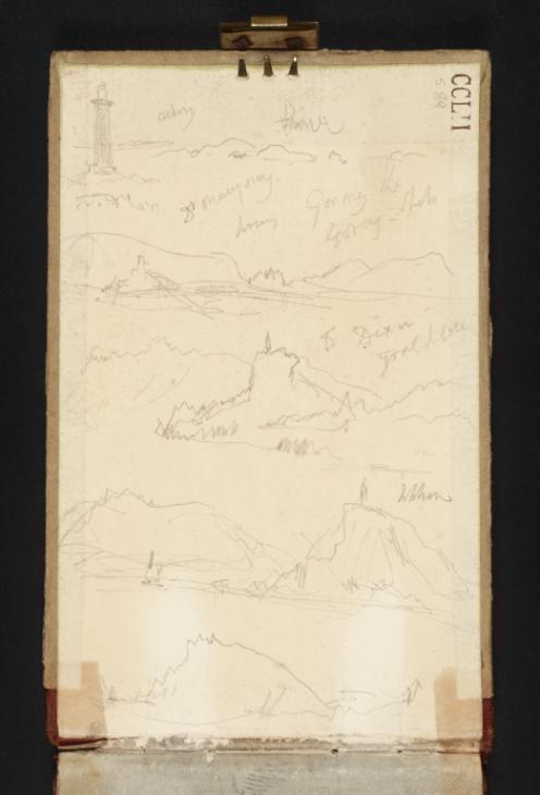
With the page turned vertically, Turner worked five coastal views onto this inside cover of the sketchbook. At the top of the page are depicted a lighthouse and distant islands. The crabbed notes above the sketch appear to identify these islands as Alderney and Herm, which would locate this view as a north-easterly vista from Guernsey’s eastern coast. The ‘H’, perhaps for Herm, inscribed below the island towards the right-hand edge of the page may be intended to reinforce this identification.
The sketch below this appears to depict a fort or castle guarding a harbour or bay. Such topography is not uncommon on Guernsey, and can be found, for example, at St Peter Port and St Sampson Harbour to the east and at Rocquaine Bay to the west. The semi-legible notes above the sketch do not allow any more specific identification than this. From left to right, these read, St Marjoury (which does not feature on contemporary maps of the Channel Island), Guernsey three times, and Sark.
The bottom three sketches depict high jagged rocks and cliffs above coastlines. A note on the right-hand side of the page, just above the top of these views reads ‘Great Sark’, possibly locating this scenery on the main landform of that island. Just above this note is inscribed ‘S Dixon’, presumably a person whose name Turner wished to record.


