J.M.W. Turner: Sketchbooks, Drawings and Watercolours

ISBN 978-1-84976-386-8

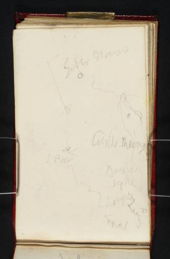
Joseph Mallord William Turner A Sketch Map 1831

Joseph Mallord William Turner 1775–1851
Folio 24 Verso:
A Sketch Map 1831
D25685
Turner Bequest CCLXV 24a
Pencil on white wove paper, 96 x 59 mm
Inscribed in pencil by Turner
 
Accepted by the nation as part of the Turner Bequest 1856
Turner’s inscription reads:
[...] House 
 
S. Port      Castle Mary 
             Roxbro 
             Light 
             Crailing 
             Qu[...] 
             M[...] 
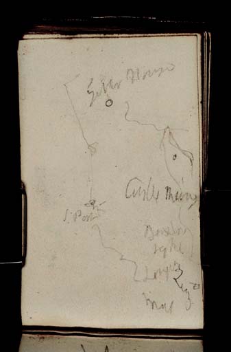
Although some of the place names on this sketched map are discernible, it has not been possible to make sense of the whole. Several connected lines are likely to be rivers with towns or notable places marked with circles or dots. David Wallace-Hadrill has read one of the words as ‘Roxbro’, meaning Roxburgh,1 suggesting that this is a map of the rivers Teviot and Tweed in Roxburghshire. With this in mind, Janet Carolan, adding notes to Wallace-Hadrill’s, suggested that one of the inscriptions could refer to Floors Castle near Kelso.2 Another inscription could read ‘Castle Mary’, referring to one of the many castles in Scotland associated with Mary Queen of Scots.
Unfortunately, Turner’s unclear drawing and poor handwriting mean that the rest of the map has not been deciphered and as a whole it is still not understood.

Thomas Ardill
September 2009

1
David Wallace-Hadrill, ‘Berwick CCLXV checklist’, [circa 1992], Tate catalogue files.
2
Ibid.

How to cite

Thomas Ardill, ‘A Sketch Map 1831 by Joseph Mallord William Turner’, catalogue entry, September 2009, in David Blayney Brown (ed.), J.M.W. Turner: Sketchbooks, Drawings and Watercolours, Tate Research Publication, December 2012, https://www.tate.org.uk/art/research-publications/jmw-turner/joseph-mallord-william-turner-a-sketch-map-r1134049, accessed 12 January 2025.